
Location in Spain:
Category:
Hotels/apartments near La Breña and Barbate Natural Park
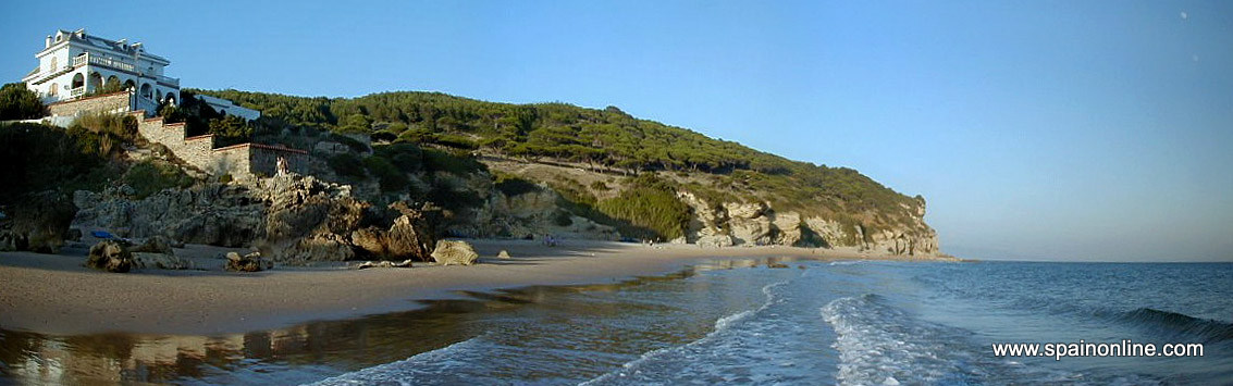
La Breña y marismas (marshes) de Barbate Natural Park, situated on the Costa de la Luz, the Atlantic coast of the province of Cadiz, is one of three protected areas in Andalusia that include a maritime zone, thus making them sea-land parks.
The park covers a total area of 5,077 hectares of which 3,925 hectares are land and 1,152 marine. Although it is one of the smaller natural parks in Andalusia, it is home to five different ecosystems: ocean, cliffs, pine... Due to its location at the entrance to the Strait of Gibraltar, it is also a support point for the migratory routes of birds in the marshes of Barbate.
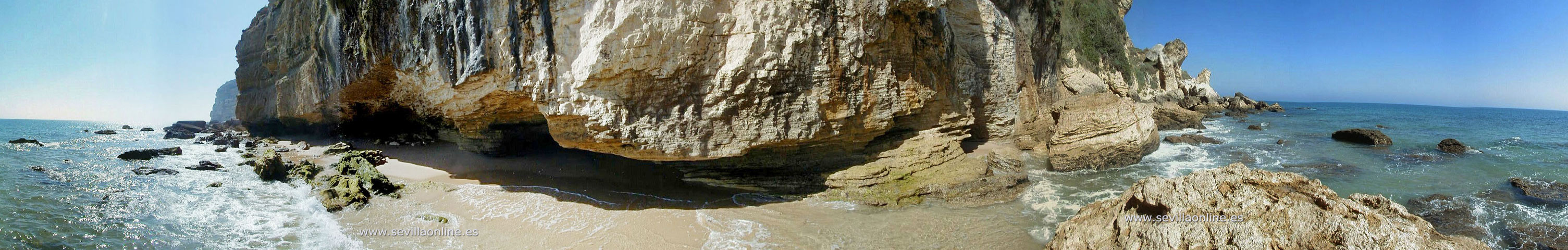
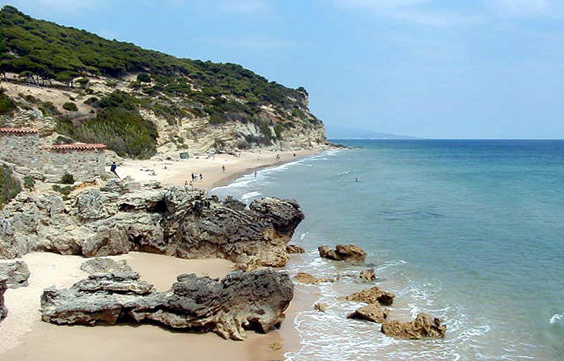
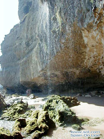
One of the most impressive sights in the park is the Tajo de Barbate; The most notorious cliff on the Andalusian Atlantic coast. This coastal cliff has elevation points of more than 100 m above sea level. The Torre del Tajo (Tajo Tower) is situated at these high altitudes and it offers spectacular views over the blue waters of the Strait. At the foot of the escarpment, in the water, there are several big blocks created by the erosive action of the waves, and there are also smaller sandy deposits which are covered during high tides.
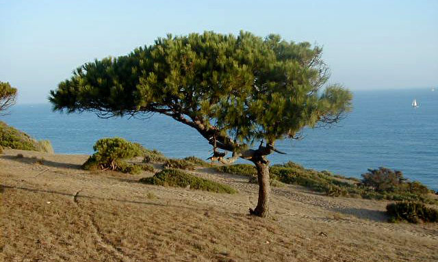
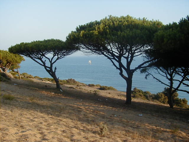
The top of the cliff is colonized by a pine forest with an undergrowth of Mediterranean scrub. The forest is the result of reforestation carried out at the end of last century. There are some varieties of Aleppo pine mixed with juniper bushes and shrubs on the edges of the cliffs. They are packed tightly together in order to withstand the strong coastal winds. Nesting birds on the cliff are mainly composed of greenfinches, goldfinches, chaffinches, tits and the crested tit. There is also a pair of peregrine falcons and another pair of kestrels.
Both the cliff-top forest, with its stunning views, and the wild and rugged beach at the foot of the cliff are well worth a visit.
The salty sea air is due to small drops of sea water rising in the wind and crashing against the rocks, creating the so-called "saline spray". These physical conditions have lead to the growth of various plants on the cliff face that commonly grow in marshland or saline environments. These are halophytes species and include evergreen, sweet almajos and barrilla. Wild fig trees and brambles grow in the larger and more sheltered areas.
The rocky cliff walls are a breeding ground for various species of birds. The colony of herring gulls is the oldest, but the largest bird population in the park is the egret. Jackdaws and black starlings nest in colonies in the Tajo Tower and in the many crevices and ledges of the cliff.
The marine part of the park is made up of one nautical mile along the coast, consisting of rocky blocks which have fallen from the cliff over time. The biological communities indigenous to these habitats are strongly influenced by tidal movements. Mollusks such as limpets and periwinkle can be found in the upper areas.
There is no human settlements inside the park, although the town of Barbate is located close to the park's eastern border. The main resource provided by the park is the collection of pine cones and pine nuts, as such a large extent of the park is occupied by pine forests. The park is also used for livestock rearing (mainly sheep). However, the local commercial port and salted fish industry absorb most of the workforce population.
There are two tower beacons located on the highest point of the cliff (Torre del Tajo) and on the far west side of Paraje (162 m high). These are two coastal watchtowers dating back to the sixteenth and seventeenth centuries. Both are located in places of great scenic beauty. Two shrines from the Visigoth period of occupation can be found next to the park. They are known as the 'Ermita de San Ambrosio' (situated beside the town of the same name), and the Olive Sanctuary (Sanctuario de la Oliva) on the Vejer-Barbate road.